For my second journey into the Hoosier National Forest, I made a trip to the spectacular Wesley Chapel Gulf, located in a small section of the Hoosier National Forest between Orleans, Paoli, and French Lick. If you’re unfamiliar as I was, Wesley Chapel Gulf is a 187-acre stretch of unique topography in southern Indiana, designated as a National Natural Landmark. The Gulf is special because of the unique surface features of the Lost River that runs through the area. The Gulf is essentially a massive chasm in the ground caused by a collapse of rock (a sinkhole) into the underground part of the Lost River. The Lost River is an 87-mile stretch of water that starts in Washington County and ends up dumping into the East Fork of the White River. The river is so named because 23 miles of it runs underground.

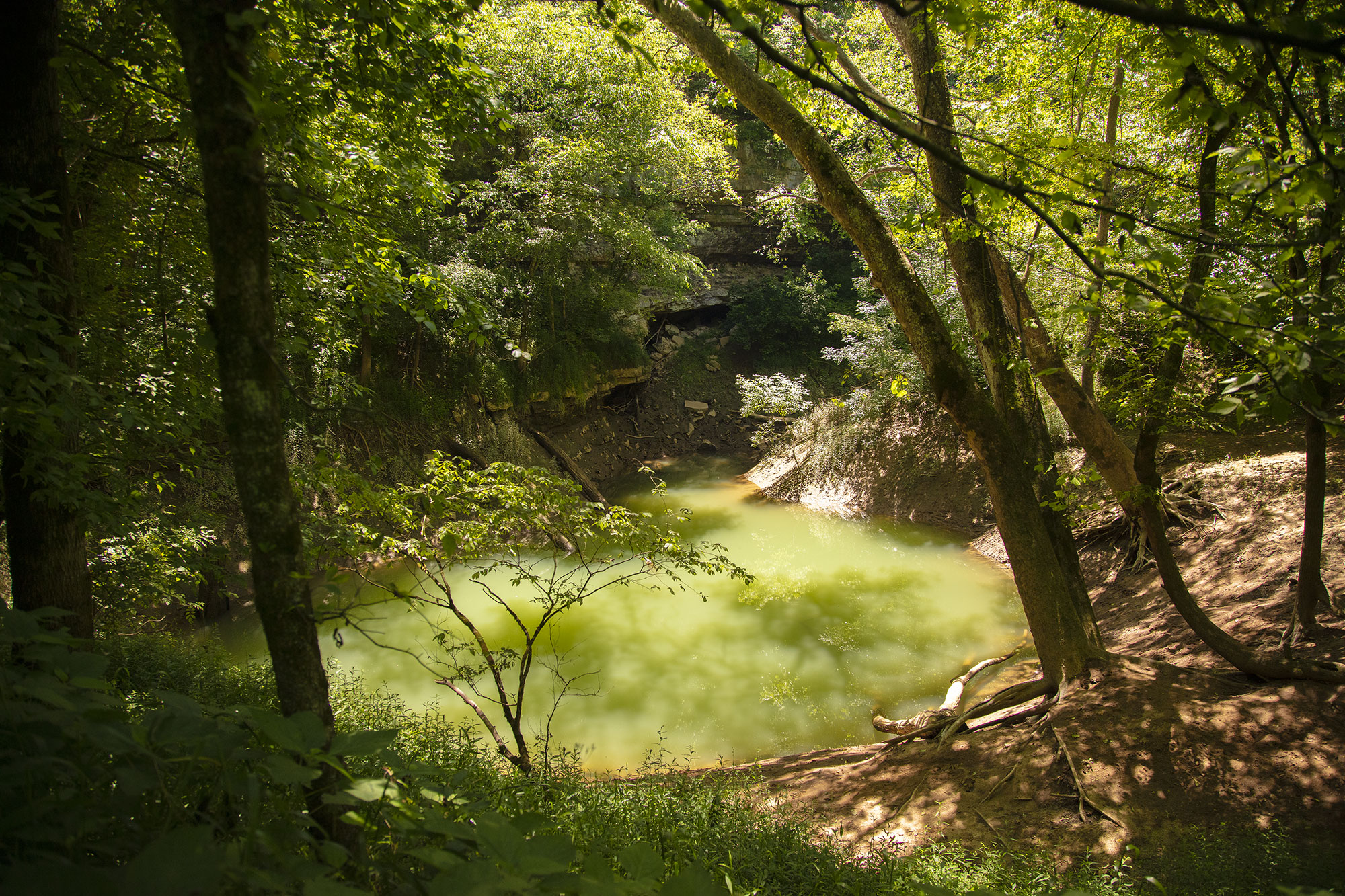
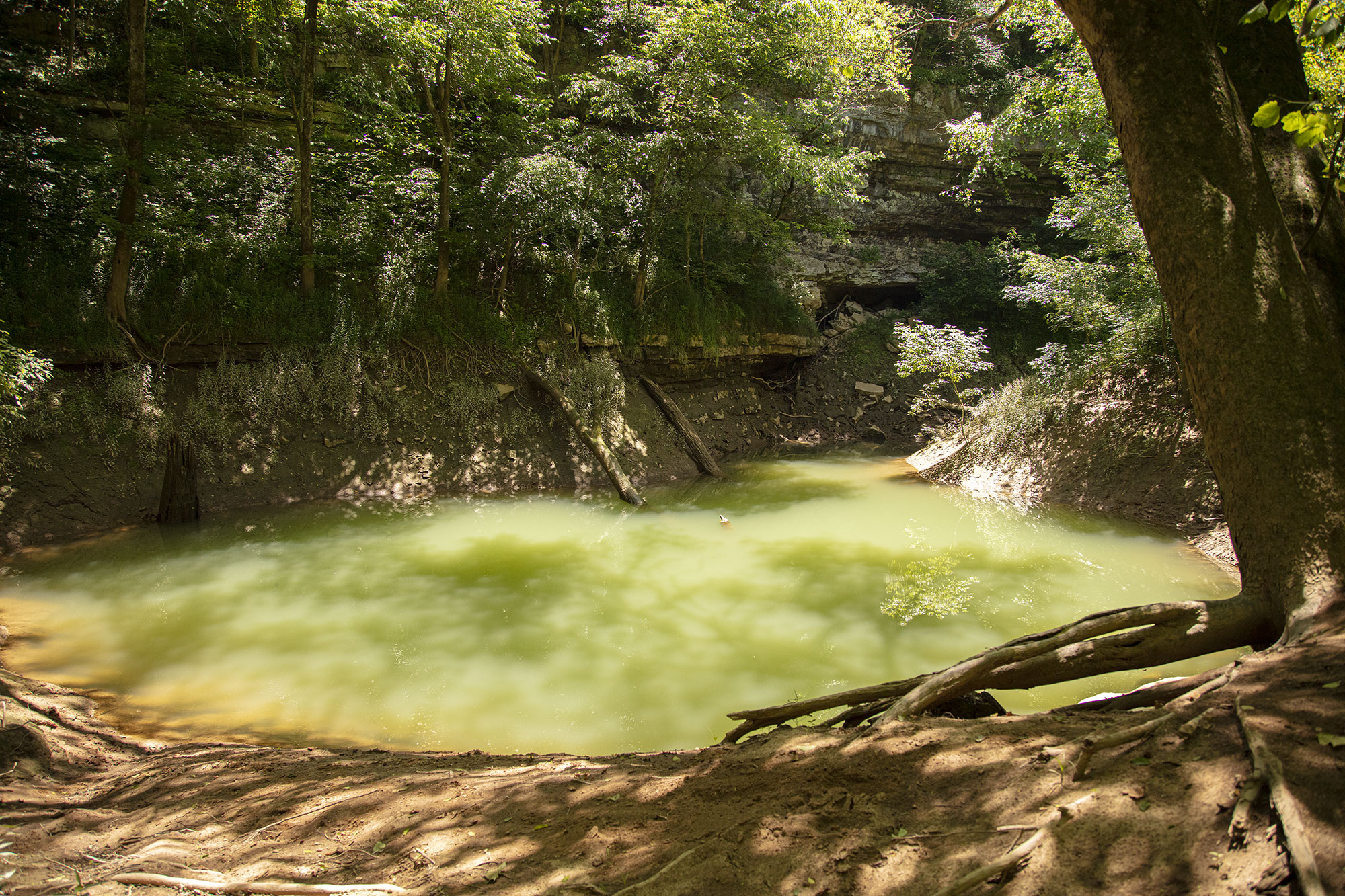
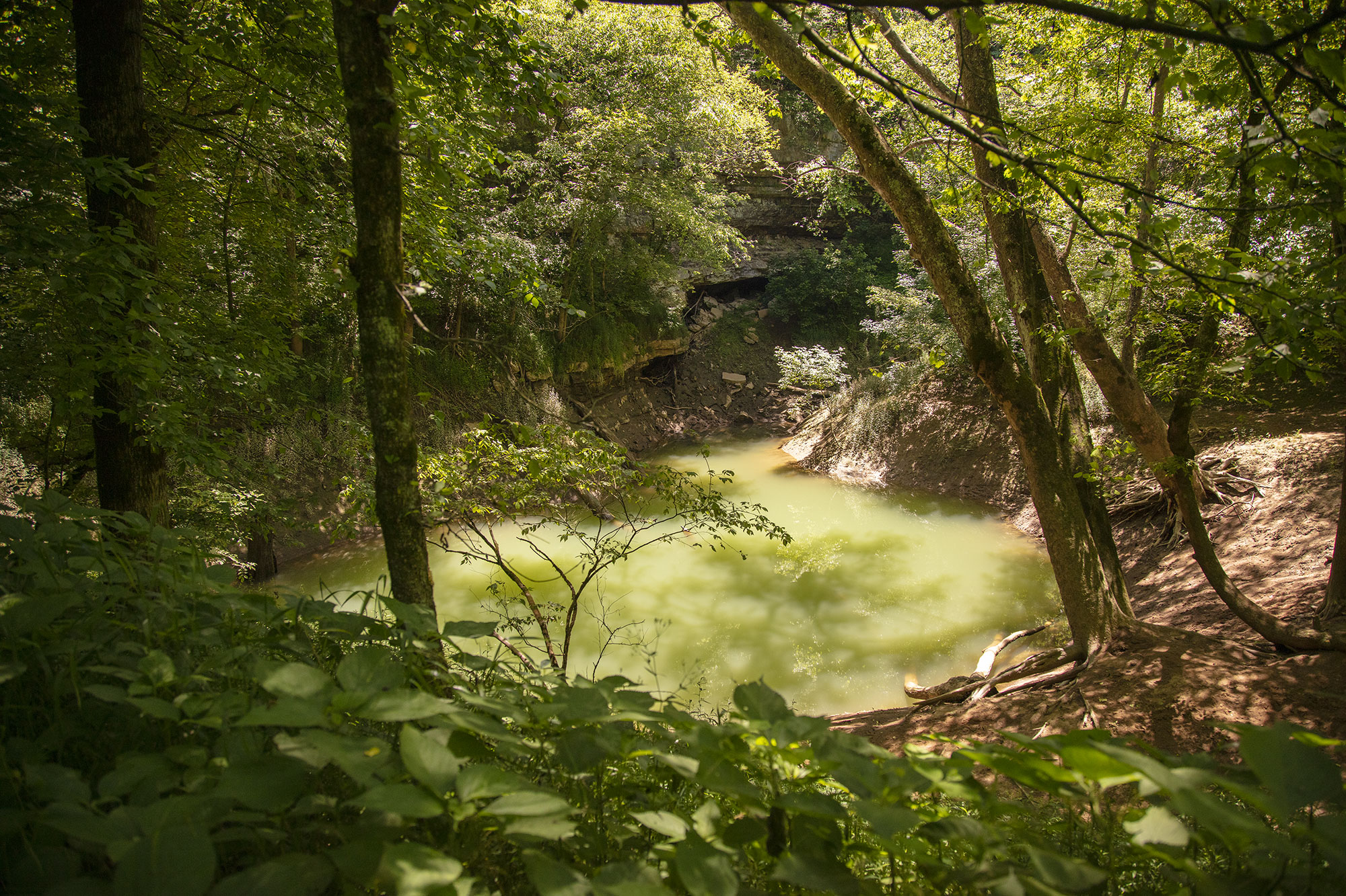
Sinkholes and caves exist along the river as part of the karst land topography of southern Indiana. The Lost River disappears underground just before the Gulf, surfaces at the Gulf, and disappears again. The main feature of the Gulf is the Boiling Spring, a beautiful pool of water found at the bottom of a limestone wall. The beauty of the pool is matched by the canopy of trees, which shades the steep shore. It’s muddy around the Boiling Spring (and in several areas on the trail), so be prepared, but the Gulf is worth the walk. The trail itself is a great experience as well.

The pool is called the Boiling Spring due to the turbidity that happens in heavy rains. According to the United States Forestry Service website, “Following very heavy rains, the gulf floor may become completely inundated by up to five feet of water. At such times the waters issuing from the pit are violently turbulent, and great boils of rising waters discharge from it. As much as 4,000 - 5,000 cubic feet per second issue from the underground course of Lost River.”
I found Wesley Chapel Gulf to be a genuinely magical place. I’ve traveled to many beautiful locales in the great Hoosier state, but the Gulf is someplace uniquely spectacular to visit. Its seclusion, geology, and ambiance make the Wesley Gulf Chapel a destination worth putting on your bucket list.

History For many years, the area adjacent to the Gulf was farmed. During the earliest days of Euro-American settlement, the Gulf became a place for nearby communities to collect fresh water. In time, it became a point of fascination for locals and was known as Shirley Gulf and then later as Elrod Gulf. The Gulf is now named after Wesley Chapel, a nearby United Methodist Church. In 1972, the Gulf was designated as a National Natural Landmark. The Forest Service obtained the property in 1996.

What You Need The property is maintained, but it isn’t a park in the traditional sense. The paths travel over somewhat rough terrain. If you go in summer, make sure to come with bug spray and long pants (ticks are bad in the long grass). There isn’t much parking either, so if possible, come during a weekday. I went on a Wednesday morning, and there was no one. Finally, make sure you wear hiking boots or wear some kind of stabling footwear for the wet and muddy slopes. Don’t leave trash anywhere.

Getting There Wesley Chapel Gulf is located northwest of Paoli and southwest of Orleans, about a four-minute car ride from nearby Orangeville. The fastest route is to take Indiana State Road 37 to Orleans. Go through Orleans and head south until you reach West County Road 500 North. Head west on that road until you get to the Wesley Chapel church at the corner of 500 North and North County Road 350 West. Please drive slowly, as the entrance to the Gulf is a bit hidden (it’s a gravel road).
Other Things to Consider A visit is probably not the best idea with small children and pets, as the terrain requires a certain level of sophistication to navigate. It isn’t hard to get back to the Boiling Spring, but Wesley Chapel Gulf isn’t a state park in the sense of well-worn paths and trails. Cell service is decent if you get into trouble.

