In May of 2019, the Lewis and Clark National Historic Trail extended 1,200 miles to include segments along the Ohio River, from St. Louis to Pittsburgh. The original trail, established in the 1960s, commemorated the Lewis and Clark Expedition from St. Louis to the Pacific Coast.

Indiana State Nature Passport
Falls of the Ohio State Park is part of the Indiana State Nature Passport! Check-in and explore participating locations throughout the state to earn great prizes! The more you visit, the more you win. This program is 100% free, but property entrance fees apply when you visit. Learn More.
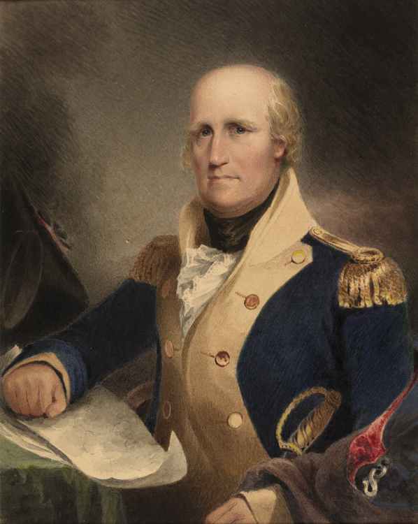
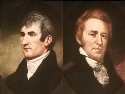 Meriwether Lewis and William Clark
On May 14, 1804, the Corps of Discovery, led by Meriwether Lewis and William Clark, departed from Camp Dubois (Camp Wood) and traveled across the North American continent, reaching the Pacific Northwest’s Columbia River in December of 1805. The following spring, they returned east, arriving back in St. Louis on September 23, 1806.
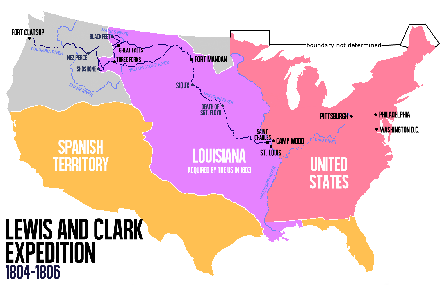
The original National Historic Trail honored this expedition but didn’t include Lewis’ first leg of the journey down Ohio, from Pittsburgh, and Lewis and Clark's journey from Clarksville to St. Louis.
After President Thomas Jefferson acquired the 820,000 square mile Louisiana Territory from France in 1803, he commissioned Meriwether Lewis to explore the purchase. After spending a month in Pittsburgh, Lewis travel down the Ohio River in September of 1803.
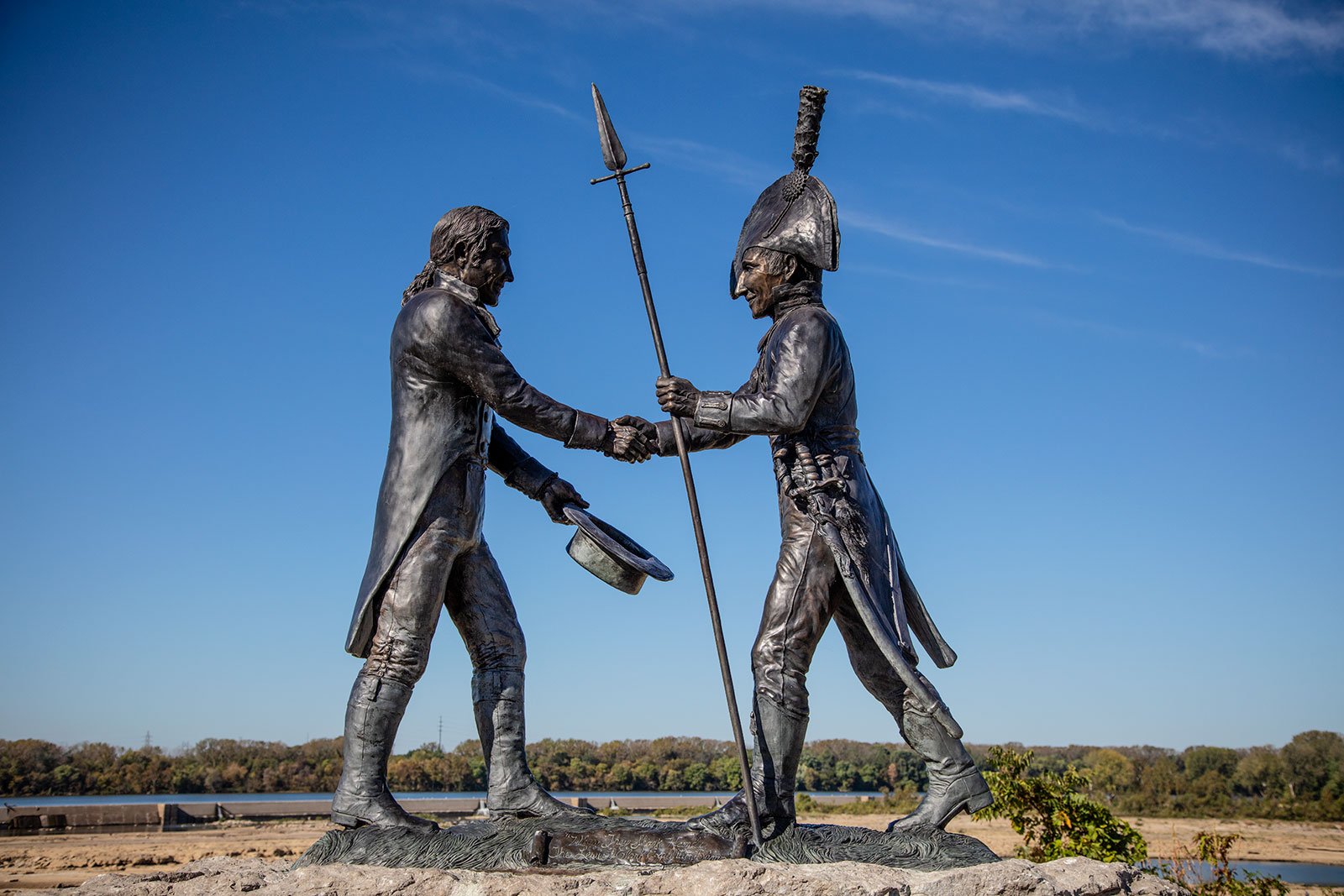
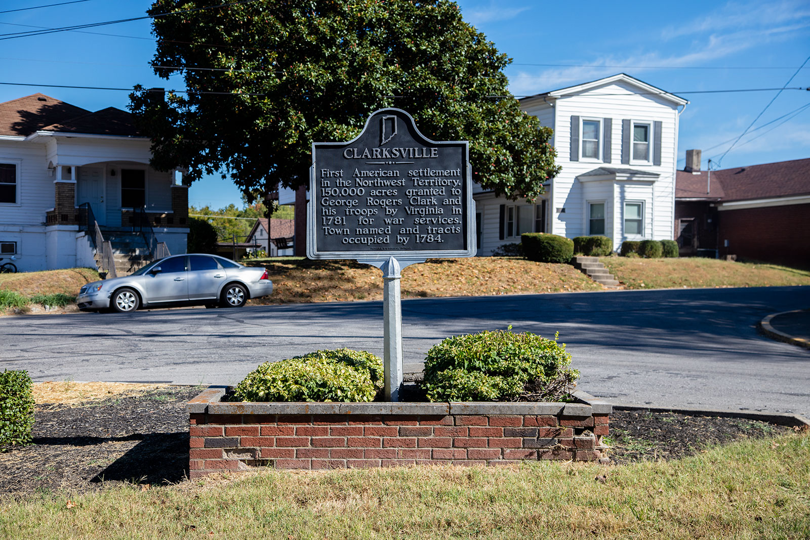
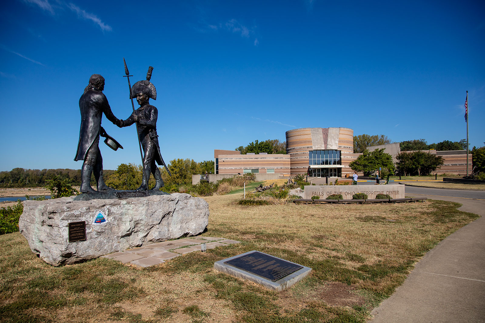
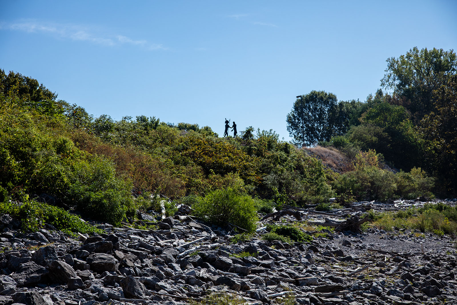
On October 14, 1803, Lewis and a small company of explorers arrived at Clarksville in the Indiana Territory, just across the river from Louisville.
Clarksville was a nascent river town established by the George Rogers Clark - frontier soldier, Revolutionary War hero, and Northwest Territory colonist. His brother, William Clark, had been living with him in the new territory.
Together, the team gathered additional supplies and planned their journey into the west.
By December of that year, the party had traveled down the Ohio River, arriving in Missouri by the 9th. The Corps of Discovery wintered in St. Louis until their departure the following May.
In March of 2019, the Eastern Legacy Extension Act was signed into law, adding 1,200 miles to the Lewis and Clark National Historic Trail, for a total of 4,900 miles. The trail follows the Ohio River to the Mississippi River, then north to St. Louis, and northwest to North Dakota. From there, it turns west towards the Pacific coast, eventually terminating in the mouth of the Columbia River on the Oregon Coast.
 Falls of the Ohio State Park
In Indiana, the trail follows the Ohio River from the Indiana/Ohio border, to Clarksville, then southwest towards Indiana’s toe just south of Mount Vernon. Lewis’ October 1803 meeting with Clark has been honored for several years at the Falls of the Ohio State Park and at the George Rogers Clark Homesite.
***The George Rogers Clark Homesite is currently closed due to a fire.
To inspire travelers from around the world, they have built an interactive map that lists the top things to do and see as you journey across the trail.
